The De Gerlache-Kocher Massif serves as a critical focal point for future human lunar exploration and sustainable settlement

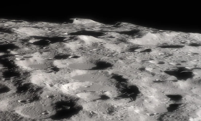
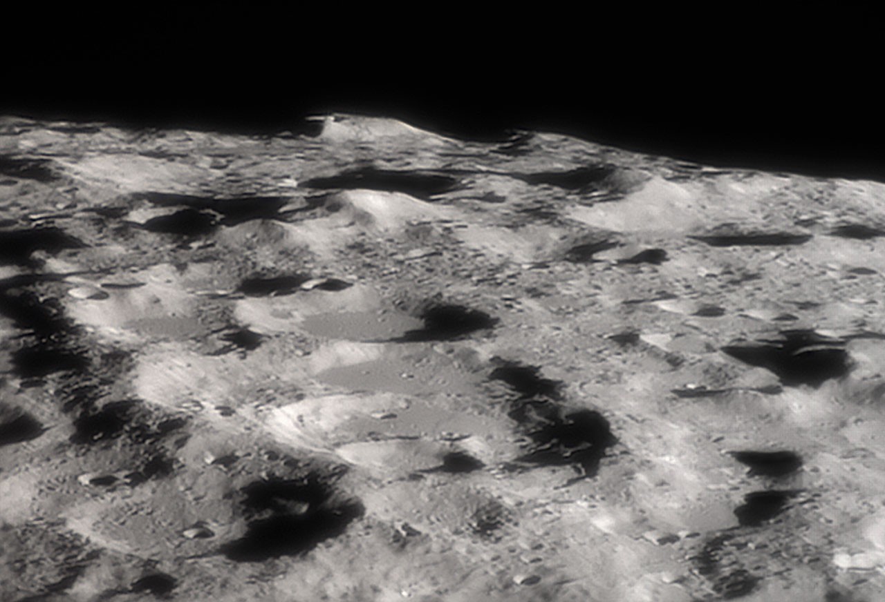
The lunar south pole, long shrouded in both literal and figurative mystery, has recently emerged as the most strategic frontier for humanity’s return to the Moon. High-resolution telescopic imagery captured on October 31 reveals the rugged topography of the De Gerlache-Kocher massif, a mountainous formation situated at the lunar limb. This region is not merely a subject of astronomical interest; it is the cornerstone of NASA’s Artemis program and the broader international effort to establish a long-term human presence beyond low-Earth orbit. The massif, which rises approximately 4 kilometers above the surrounding lunar landscape, represents a unique convergence of scientific, logistical, and architectural challenges that space agencies are now moving to address.
Geological Significance and Topographical Features
The De Gerlache-Kocher massif is characterized by its proximity to the lunar south pole, a region defined by extreme lighting conditions. Because the Moon’s axis of rotation is tilted only 1.5 degrees—compared to Earth’s 23.5 degrees—the poles do not experience the same seasonal transitions. This orientation results in "peaks of eternal light," where elevated terrain features remain bathed in nearly continuous sunlight for extended periods. Conversely, the deep craters in the immediate vicinity remain in perpetual shadow, shielded from the Sun’s radiation for billions of years.
These permanently shadowed regions (PSRs) are of profound interest to geologists and planetary scientists. Cold-trap environments within these craters allow for the accumulation of volatile compounds, most notably water ice. The presence of accessible water ice is a fundamental prerequisite for human survival, as it provides a source for drinking water, oxygen production, and the manufacturing of liquid hydrogen and liquid oxygen for rocket propellant. The De Gerlache-Kocher massif acts as a topographical anchor point, providing high ground for energy-harvesting infrastructure while overlooking the resource-rich, frozen depths of nearby impact basins.
Chronology of Lunar South Pole Exploration
The focus on the south pole is the culmination of decades of remote sensing data and orbital reconnaissance. The timeline of discovery leading to the current interest in this specific massif includes:
- 1994: The Clementine mission provides initial evidence of potential water ice deposits near the lunar south pole, detected via radar bistatic scattering experiments.
- 1998: NASA’s Lunar Prospector confirms elevated hydrogen concentrations at the poles, strongly suggesting the presence of water ice.
- 2009: The Lunar Reconnaissance Orbiter (LRO) is launched, providing unprecedented high-resolution mapping of the lunar surface. The LRO’s data has been essential in identifying the De Gerlache-Kocher massif as a viable landing and operational zone.
- 2020: NASA formally identifies 13 candidate landing regions for the Artemis III mission, all located within six degrees of the lunar south pole.
- 2026: Advanced telescopic imaging, aided by favorable lunar libration, provides the current high-definition view of the massif, confirming its structural integrity for future heavy-lander operations.
Technical Challenges and Libration Dynamics
The image of the massif was captured on October 31, utilizing a phenomenon known as lunar libration. Because the Moon’s orbit is elliptical and its rotation is slightly irregular, the Moon appears to "wobble" relative to an observer on Earth. This libration allows Earth-based telescopes to peer slightly over the edge of the lunar limb, exposing features that are usually hidden behind the horizon. This specific observational window provided a rare, oblique perspective on the south polar terrain, allowing researchers to evaluate the slope angles and potential obstacles that a crewed lander or an autonomous rover would face upon touchdown.
From an engineering perspective, landing at the south pole is significantly more complex than the equatorial landings of the Apollo era. The low sun angle creates long, distorted shadows that can deceive optical navigation systems. Furthermore, the jagged nature of the terrain necessitates advanced hazard detection and avoidance (HDA) software. The De Gerlache-Kocher massif’s steep gradients require precision navigation to ensure that hardware is placed on stable, sun-lit platforms rather than slipping into the treacherous, boulder-strewn slopes that lead into the crater interiors.
Strategic Implications for Artemis IV and Beyond
NASA’s Artemis IV mission represents a significant leap forward in this pursuit. Unlike the initial sorties of Artemis III, which are designed for short-duration surface exploration, subsequent missions aim to build the infrastructure for the Lunar Gateway and a permanent surface habitat. The selection of sites near the De Gerlache-Kocher massif is not arbitrary; it is part of a deliberate "campsite" philosophy. By positioning a base of operations on a plateau near the massif, mission planners can maximize the utility of solar energy arrays while maintaining a short logistical distance to the ice-rich PSRs.
International partners, including the European Space Agency (ESA) and private sector aerospace contractors, are currently developing the technologies required to bridge the gap between orbital infrastructure and surface operations. This includes the development of the Lunar Terrain Vehicle (LTV) and pressurized habitation modules designed to withstand the harsh lunar environment, which includes extreme temperature swings and abrasive lunar regolith.
Official Stance and Scientific Consensus
NASA officials have frequently emphasized that the Artemis program is built upon a foundation of scientific discovery rather than purely geopolitical competition. The data gathered from the south pole is expected to provide insights into the early history of the inner solar system. The ice stored within the shadowed regions acts as a planetary archive, containing isotopes and molecules that have remained undisturbed since the Moon’s formation.
In a recent technical briefing, representatives from the Lunar Exploration Analysis Group (LEAG) noted that the De Gerlache-Kocher region represents the "optimal balance" between safety and scientific yield. While other regions of the Moon are easier to access from an orbital mechanics standpoint, they lack the specific resource profile required for a permanent base. The massif is viewed as the "gateway" to a sustainable lunar economy, where the extraction of water ice could eventually transform the Moon into a refueling station for missions destined for Mars and the outer solar system.
Societal and Economic Impact
The move to establish a permanent presence at the lunar south pole has broader implications for global industry. The "cislunar economy"—a term describing the commercial activity taking place between Earth and the Moon—is projected to grow significantly as government agencies and private firms begin to invest in lunar logistics, communication relays, and power generation.
The implications for international law are equally significant. The Outer Space Treaty of 1967 provides the framework for non-appropriation of celestial bodies, yet the practical realities of mining lunar resources for fuel are creating a need for new regulatory norms. The Artemis Accords, signed by dozens of nations, represent an attempt to establish common principles for the exploration and use of lunar resources, ensuring that the development of sites like the De Gerlache-Kocher massif remains transparent and collaborative.
Conclusion
As the scientific community continues to analyze the October 31 imagery, the De Gerlache-Kocher massif stands as a silent sentinel at the edge of the world. It is a place of stark contrasts—where light and shadow, antiquity and innovation, and scientific inquiry and survival meet. While the challenges of operating in such an environment are immense, the potential rewards—a permanent human presence on another world and a sustainable path to deeper space exploration—are driving a new era of progress. The massif is no longer just a feature of a distant, grey landscape; it has become a central pillar in the blueprint for humanity’s future among the stars. Whether through the lens of a telescope or the descent engine of a future lander, the focus on this lunar landmark underscores a fundamental human drive to explore, occupy, and eventually, to thrive in the vacuum of space.