Hanwha Aerospace and Satrec Initiative Push Boundaries of Earth Observation with Ultra-High-Resolution Optical and SAR Constellations


PARIS — In a sweeping strategic maneuver designed to capture a dominant share of the defense and intelligence markets, South Korean aerospace giant Hanwha Aerospace and its subsidiary, Satrec Initiative, are aggressively advancing plans to deploy a groundbreaking, multi-tier Earth observation network. Revealed during high-level industry discussions at the World Space Business Week conference in Paris, the initiative pairs an extensive synthetic-aperture-radar (SAR) constellation with upcoming 10-centimeter-class very-high-resolution optical satellites. This dual-capability architecture aims to fundamentally redefine the parameters of "Satellite as a Service" (SaaS) by delivering unprecedented revisit rates, ultra-crisp imagery, and artificial intelligence-driven analytics to global defense and intelligence customers.
The ambitious program underscores a major structural shift in the commercial and military remote sensing sectors. As geopolitical tensions mount and nations increasingly prioritize sovereign space assets, the demand for timely, high-fidelity Earth data has surged. By integrating advanced radar imaging—which pierces through cloud cover and operates seamlessly in darkness—with hyper-detailed optical payloads capable of discerning minute features on the Earth’s surface, Hanwha and Satrec Initiative are positioning themselves at the vanguard of the global commercial space market.
Convergence of Optical and SAR Technologies
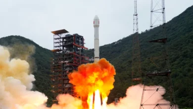
At the core of this joint endeavor is the synthesis of two distinct, highly complementary remote sensing technologies. Satrec Initiative, renowned for its expertise in high-performance optical payloads, currently acquires sharp 25-centimeter optical imagery via its SpaceEye-T satellite, which successfully launched in 2025. This capability has already garnered commercial traction, including recent lease agreements with European customers seeking reliable, high-resolution optical data streams.

However, the modern intelligence landscape demands more than static, daytime optical photography. To address this, Hanwha announced plans in July for a massive 64-satellite SAR constellation. Scheduled for full deployment by 2031, this radar network is engineered to provide an astonishing 30-minute revisit rate over areas of interest, ensuring that military commanders and intelligence analysts can track dynamic events on the ground regardless of weather conditions or time of day.
To bridge the gap between wide-area radar tracking and pinpoint visual identification, Satrec Initiative is now expanding its roadmap. Eugene Kim, executive vice president of Satrec Initiative, outlined the company’s intent to manufacture and launch four specialized satellites designed to capture ultra-high-resolution optical imagery in the 10-centimeter class.
"Together with ultra-high-resolution SAR and ultra-high-resolution electro-optical, the constellation is expected to open up new opportunities to provide Satellite as a Service in the defense and intelligence field," Kim told SpaceNews during the Paris conference.
Furthermore, the raw data streams will not merely be delivered as static imagery. Customers will also leverage AI-based satellite imagery analysis developed by SI Analytics, a specialized Satrec Initiative spin-off. This integrated analytics layer is designed to filter out the noise of massive data collections, turning raw pixels into timely, accurate, and actionable intelligence for end-users operating in high-stakes environments.

The Push Toward Sub-Decimeter Resolution
The commercial Earth observation market is currently experiencing a fierce resolution race, driven by advancements in optical design, agile spacecraft bus manufacturing, and processing algorithms. Industry leaders are aggressively pushing past traditional thresholds to offer customers clearer views from space.
For context, legacy commercial systems traditionally operated in the 50-centimeter to 1-meter resolution bracket. Today, however, the benchmark is rapidly shifting toward sub-20-centimeter territory. European aerospace titan Airbus is actively developing its Pléiades Neo Next satellites, slated to gather 20-centimeter imagery by 2028. Similarly, commercial operators like Vantor are building out their Vantage constellation to secure 20-centimeter-class capabilities, while ImageSat International (ISI) announced plans in September to field Earth imagery systems with a 25-centimeter native resolution.
By targeting the 10-centimeter class, Satrec Initiative and Hanwha are leaping past current industry standards. Achieving this level of optical clarity from orbit is an extraordinary technical hurdle. At 10 centimeters of resolution, space-based sensors can distinguish individual vehicle types, infrastructure components, and specific tactical markings—data points traditionally reserved for classified military reconnaissance platforms rather than commercial enterprises.
Engineering Challenges in Very Low Earth Orbit
To achieve 10-centimeter-class optical resolution without building prohibitively massive and expensive telescopes, Hanwha and Satrec Initiative must alter the physics of orbital mechanics. Traditionally, high-resolution optical satellites reside in sun-synchronous orbits ranging from 500 to 600 kilometers above the Earth. However, viewing the ground at sub-decimeter clarity from that distance requires gargantuan optical assemblies.

The solution lies in descending closer to the target. Hanwha’s upcoming ultra-high-resolution optical satellites are designed to operate in Very Low Earth Orbit (VLEO), specifically at altitudes dipping below 400 kilometers. By cutting the orbital distance nearly in half, the satellites can achieve vastly superior ground resolution with comparatively compact optical payloads.
Yet, operating in VLEO introduces severe engineering and operational hazards. The lower thermosphere is notoriously hostile to spacecraft. Atmospheric drag is exponentially higher at altitudes under 400 kilometers, requiring constant, propulsive orbit-keeping maneuvers that can quickly exhaust a satellite’s fuel supply. Furthermore, the higher density of atomic oxygen at these altitudes chemically erodes spacecraft materials, degrading solar arrays, optical coatings, and exterior thermal blankets over time.
Recognizing these formidable risks, Hanwha has adopted a methodical, incremental flight-test strategy. According to company disclosures, Hanwha plans to begin its VLEO deployment by launching a pathfinder test satellite near an altitude of 500 kilometers. Once on orbit and validated, the spacecraft will progressively lower its altitude in steps, collecting vital empirical data regarding atmospheric drag, atomic oxygen interaction, and thermal dynamics. This data will directly inform the engineering and material science decisions for subsequent production spacecraft intended to operate permanently in the sub-400-kilometer regime.
Chronology and Strategic Roadmap
The integration of Hanwha and Satrec Initiative’s remote sensing assets follows a carefully calibrated timeline that stretches from recent past milestones through the turn of the decade:

- 2025: Satrec Initiative successfully launches the SpaceEye-T satellite, establishing its commercial footprint in the 25-centimeter optical imaging market and securing early European customer leases.
- July 2026: Hanwha officially announces its expansive 64-satellite SAR constellation, establishing a targeted 30-minute revisit rate to be fully realized by 2031, alongside initial disclosures regarding VLEO technology development pathways.
- September 2026: Executives from Satrec Initiative outline the strategy for four upcoming 10-centimeter-class optical satellites at the World Space Business Week conference in Paris, cementing the multi-tier optical-SAR architecture.
- 2028–2031: The broader commercial market anticipates a wave of high-resolution deployments, including Airbus’s Pléiades Neo Next, leading up to the finalization of Hanwha’s 64-satellite SAR network and the operational rollout of its VLEO optical fleet.
Market Implications and the Future of Sovereign Space
The convergence of Hanwha’s industrial manufacturing scale and Satrec Initiative’s technical acumen represents a broader national and corporate strategy: achieving complete "space sovereignty." For South Korea, developing an indigenous, end-to-end Earth observation capability—spanning heavy manufacturing, specialized sensors, VLEO operations, SAR radar, and AI-driven intelligence analytics—reduces reliance on foreign intelligence providers and positions the nation as a formidable exporter of defense-grade space services.
As the lines between commercial remote sensing and military intelligence continue to blur, the success of Hanwha and Satrec Initiative’s VLEO and SAR roadmap will likely serve as a bellwether for the entire aerospace sector. If the companies can successfully master the punishing physics of Very Low Earth Orbit while scaling their manufacturing pipelines to meet aggressive constellation timelines, they will establish a new benchmark for what commercial satellite operators can deliver to defense and intelligence agencies worldwide.
Related posts: