EU Imposes 24-Hour Delay on Copernicus Satellite Imagery in Gulf of Oman Following United States Security Request

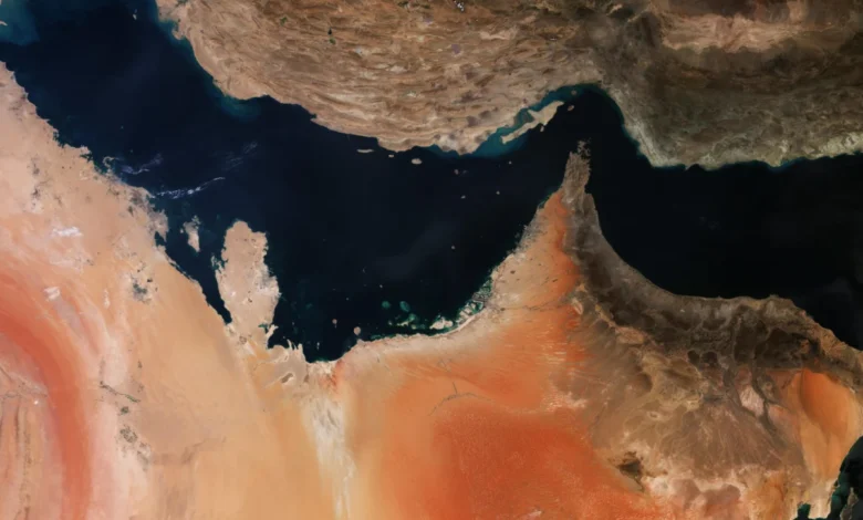
In a significant departure from its long-standing "free and open" data policy, the European Union has mandated a 24-hour delay in the public release of satellite imagery from its Copernicus program covering specific sectors of the Gulf of Oman. This decision follows a formal security request from the United States government, which expressed concerns that real-time Earth observation data could be leveraged by adversarial actors amidst escalating regional tensions. The restriction specifically targets the Sentinel-1 and Sentinel-2 satellite constellations, the workhorses of Europe’s space-based monitoring capabilities, and marks a pivotal moment in the intersection of commercial space transparency and international security.
The Council of the European Union finalized the decision in mid-July, identifying a "specific geographical area" that encompasses vital shipping lanes leading to and from the Strait of Hormuz. By defining the restricted zone through five precise sets of latitude and longitude coordinates, the EU aims to obscure immediate maritime movements in a region that has become a flashpoint for military friction between the United States and Iran. While the Copernicus program is celebrated for providing high-resolution, near-real-time data to researchers and businesses globally, the recent geopolitical climate has forced a reevaluation of how that data is disseminated during active conflicts.
The Geopolitical Context and the Strait of Hormuz
The Gulf of Oman and the adjacent Strait of Hormuz represent perhaps the most sensitive maritime chokepoints in the world. Approximately one-fifth of the world’s total oil consumption passes through the Strait daily, making it a vital artery for global energy security. In recent months, following the outbreak of direct military hostilities between U.S. forces and Iranian units, the region has seen an increase in naval patrols, tanker seizures, and electronic warfare incidents.
The U.S. government’s request for a data delay is rooted in the "tactical utility" of satellite imagery. High-revisit constellations like Sentinel-1, which uses Synthetic Aperture Radar (SAR) to see through clouds and darkness, and Sentinel-2, which provides high-resolution optical imagery, allow observers to track ship movements, port activity, and military deployments with high precision. In a conflict scenario, 24 hours can be the difference between a successful tactical maneuver and a compromised operation. By ensuring that the public—and by extension, intelligence agencies of non-allied states—cannot access "live" feeds of the Gulf, the U.S. and its allies aim to maintain a level of operational security.
Chronology of the Decision
The path toward this restrictive measure began in late May 2026. According to internal documents and Council reports, the timeline of the decision reflects a deliberative but urgent process within the EU’s security framework:
- May 26, 2026: United States authorities submit a formal diplomatic démarche to the European Union. The request specifically asks for limitations on the dissemination of Earth observation data over the Gulf of Oman, citing the potential for the data to be used by "third states or non-state actors" to threaten the interests of the U.S. and its allies.
- June 10, 2026: The EU’s Political and Security Committee (PSC) meets to review the U.S. request. The committee, which deals with Common Foreign and Security Policy (CFSP) and Common Security and Defence Policy (CSDP), provides a favorable opinion, acknowledging the validity of the security risks described.
- July 13, 2026: Council President Kaja Kallas signs the formal decision. The measure is enacted under the EU’s "Space Threat Response Architecture," a regulatory framework established to allow the Council to issue emergency instructions to the managers of EU space systems during crises.
- July 20, 2026: The Council of the EU confirms the adoption of the measure in an official document (ST-11929-2026-REV-1). Although the decision was finalized, it was not immediately published in the Official Journal, a common practice for security-sensitive directives.
Technical Scope: Sentinel-1 and Sentinel-2
The delay applies to the two most critical components of the Copernicus fleet. Understanding the capabilities of these satellites explains why the U.S. was eager to see their output delayed.
Sentinel-1 consists of a constellation of two polar-orbiting satellites performing C-band synthetic aperture radar imaging. Unlike optical satellites, Sentinel-1 does not require sunlight; it can "see" through heavy cloud cover, smoke, and total darkness. This makes it an invaluable tool for maritime surveillance, as it can detect the metallic hulls of ships and tankers regardless of weather conditions. For military planners, Sentinel-1 is essential for monitoring ship-to-ship transfers or identifying "dark" vessels that have turned off their Automatic Identification System (AIS) transponders.
Sentinel-2 provides multispectral optical imagery. While it is limited by cloud cover and night, its high-resolution images (up to 10 meters) allow for the identification of ship types, the monitoring of coastal infrastructure, and the assessment of damage following kinetic strikes. By imposing a 24-hour lag on this data, the EU effectively removes the "real-time" element that is necessary for active combat targeting or immediate tactical response.

Impact on the Commercial Space Sector
For several years, European Earth observation (EO) companies have marketed themselves as a more reliable and less restricted alternative to U.S.-based firms. When the conflict in the Middle East intensified earlier in 2026, major American providers like Planet and Vantor (formerly Maxar) quickly complied with U.S. government "shutter control" or voluntary restrictions. Planet, for instance, implemented a 96-hour delay on imagery of the region in March before moving to an indefinite hold on certain high-interest areas in April.
This created a market vacuum that European firms were quick to fill. Global energy traders, insurance companies, and maritime shipping firms—who rely on satellite data to calculate risk, verify cargo locations, and set insurance premiums—turned to Copernicus and European commercial providers. In May, Antoine Rostand, president of the French firm Kayrros, noted that Copernicus remained the "gold standard" for unrestricted data.
The EU’s new 24-hour delay complicates this narrative. It signals that even "free and open" programs are subject to the realities of geopolitical alliances. While a 24-hour delay is significantly less than the indefinite holds placed by some U.S. firms, it nonetheless disrupts the workflow of commodities traders and news organizations who require the most current data to report on developing crises.
Official Responses and Security Exceptions
A spokesperson for the European Commission defended the measure as a "technical security precaution." While the Copernicus program’s founding principles emphasize the public good and open access, the underlying regulations (specifically Regulation (EU) 2021/696) contain explicit provisions for security-related restrictions.
"The Copernicus programme operates under a free and open data policy to ensure satellite imagery is available for users worldwide," the spokesperson stated. "However, limitations to this policy for security reasons are allowed and are occasionally necessary to protect the interests of the Union and its Member States."
The spokesperson further characterized the move as a routine application of the Space Threat Response Architecture. This architecture was designed specifically for scenarios where EU space assets—like Galileo (GPS) or Copernicus—could be used against the bloc’s interests. By aligning with the U.S. request, the EU is demonstrating a unified front with its NATO allies, prioritizing regional stability over data transparency.
Analysis of Implications
The decision to delay Copernicus data has several long-term implications for the space industry and international relations:
- The End of Absolute Transparency: For decades, the EO community has championed the "democratization of space," where satellite imagery allows the public to hold governments and militaries accountable. This move reinforces the reality that in times of war, space-based transparency is a secondary priority to national security.
- Precedent for Future Conflicts: This sets a clear precedent for how the EU might handle data over other sensitive regions, such as the South China Sea or Eastern Europe. If a 24-hour delay is deemed sufficient for the Gulf of Oman, it may become the standard "security buffer" for any region involving EU allies in active hostilities.
- Economic Consequences for the Data Market: Shipping firms and insurers may now view satellite data as a less "guaranteed" resource. If the data can be throttled at the request of a foreign government, companies may invest more heavily in private, high-frequency constellations that operate under different jurisdictional rules, though even those are rarely immune to government pressure.
- Heightened Tensions with Iran: Tehran is likely to view this move as a direct act of electronic or informational warfare. By restricting the flow of data that could theoretically be used by Iranian maritime forces, the EU has moved closer to a position of active support for U.S. military objectives in the region.
The published decision does not specify an expiration date for the delay, noting only that the measure will be reviewed periodically as the security situation evolves. For now, the "eye in the sky" over the Gulf of Oman remains open, but for the first time in the history of the Copernicus program, the view it provides is a day behind reality.