A view from above: International Space Station captures the illuminated corridor of the American Midwest and East Coast

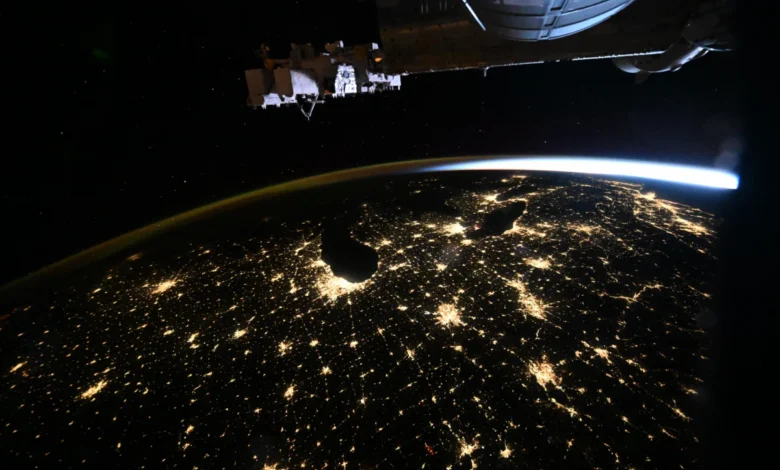
On October 18, 2026, the International Space Station (ISS) provided a unique vantage point of the North American continent, capturing a high-resolution photograph of the illuminated urban corridor stretching from the American Midwest to the Atlantic Seaboard. The image, taken at approximately 259 miles above the Earth’s surface, highlights the dense network of artificial light that defines the modern industrial and economic heart of the United States. The photograph, credited to Canadian Space Agency (CSA) astronaut Joshua Kutryk, offers a striking visual representation of urbanization and energy consumption patterns in the early morning hours.
Chronology of the Orbital Observation
The observation occurred during the pre-dawn hours of October 18, 2026, while the ISS was in a low Earth orbit (LEO). According to mission logs from the expedition, the station’s trajectory took it over the central United States, providing a clear line of sight toward the East Coast.
Astronauts aboard the ISS follow a rigorous schedule of scientific experiments, maintenance, and Earth observation. The capturing of such images is not merely a recreational pursuit but a documented part of the crew’s responsibilities to monitor environmental and developmental changes on the planet’s surface. This particular image was taken roughly two hours before sunrise, a timing that maximizes the contrast between the bioluminescent-like glow of human infrastructure and the surrounding natural terrain. The visibility of major urban centers, including Chicago, Detroit, and the New York metropolitan region, provided a distinct map of the "BosWash" corridor and the industrial heartland of the Great Lakes.
Supporting Data on Urban Light Density
The image serves as a tangible data point for researchers studying light pollution and urban sprawl. The Midwestern to East Coast corridor is one of the most densely populated regions in the Western Hemisphere. According to data provided by the U.S. Census Bureau and regional urban planning authorities, this specific stretch of land accounts for a significant percentage of the nation’s total energy consumption.
When analyzed alongside satellite data from the National Oceanic and Atmospheric Administration (NOAA), the photograph illustrates the "urban heat island" effect and the intensity of grid electrification. Major urban centers like Chicago, which functions as a primary hub for commerce and logistics, exhibit some of the highest light intensities in the country. Similarly, the New York metropolitan area remains the most illuminated node in the Western Hemisphere, a reflection of its massive population density and continuous, 24-hour economic activity.
The 259-mile altitude of the ISS is critical to these observations. At this height, the curvature of the Earth allows for a wide-angle perspective that is difficult to replicate with high-altitude aircraft. This altitude provides enough resolution to distinguish individual metropolitan clusters while maintaining a scope broad enough to see the interconnection between disparate urban systems.
Perspectives from the Space Community
While the CSA and NASA have released the image primarily as a documentation of Earth’s nighttime aesthetics, the scientific community views these contributions as essential for long-term ecological monitoring. Dr. Elena Vance, a senior researcher in orbital observation, noted that such photography is increasingly vital. "When we look at the Earth from the ISS, we aren’t just taking postcards," Vance explained. "We are collecting baseline data on how our planet’s surface is changing. The spread of artificial light over the last two decades is a direct proxy for human expansion and changes in infrastructure."
The participation of international partners, such as the CSA, underscores the collaborative nature of the ISS. Joshua Kutryk’s documentation of the American landscape highlights the seamless cooperation between space agencies. By leveraging the specific orbital paths of the ISS, agencies are able to ensure that different regions of the globe are documented under varying atmospheric conditions, which aids climatologists and urban planners in assessing light pollution’s impact on migratory bird patterns and human sleep cycles.
Analysis of Implications: Light Pollution and Infrastructure
The implications of this photograph extend beyond its immediate visual appeal. The density of light shown in the image highlights the ongoing challenges of light pollution—a phenomenon that has seen increasing scrutiny from environmental scientists. Excessive upward-directed light from urban areas is not only an energy efficiency concern but also a disruptive force for nocturnal ecosystems.
Furthermore, the data reflected in the photograph provides insight into the nation’s electrical grid resilience. The uniformity of the light output from cities like Detroit and Chicago demonstrates the robust nature of the North American power grid, which must balance extreme peak demands. Researchers often use such imagery to identify areas where lighting could be optimized to reduce energy waste, a critical component of national efforts to meet climate sustainability goals.
The economic implications are equally significant. The interconnectedness of the light patterns seen in the photograph mirrors the supply chain and logistical connections between the Midwest and the East Coast. As these cities continue to grow, the way they illuminate their infrastructure will serve as a bellwether for how the country manages energy transitions in the coming decade.
Technological Advancements in Orbital Photography
The quality of the 2026 image is a testament to the advancements in digital imaging technology aboard the ISS. Previous generations of astronauts relied on film cameras, which required complex logistics for development and storage. Today’s high-resolution digital sensors, paired with precise tracking systems, allow for the capture of images that are clearer, sharper, and more scientifically valuable than ever before.
The ISS platform allows for a variety of lenses and exposure settings to be employed. For the October 18 photograph, the combination of long-exposure settings and high-ISO capabilities was necessary to capture the faint light of urban areas while the station moved at approximately 17,500 miles per hour. This requires a high degree of technical proficiency, as even minor vibrations or miscalculations can lead to blurred images.
Broader Context of Earth Observation
Earth observation is one of the four main pillars of the International Space Station’s scientific mission, alongside life sciences, physical sciences, and technology demonstrations. By continuously monitoring the Earth, the ISS serves as a "sentinel" for the planet. The images of North American cities are often cross-referenced with meteorological data to understand how weather patterns interact with urban environments. For instance, the clarity of the lights in the image suggests a lack of significant cloud cover over the Midwest and East Coast at the time of the capture, allowing for a rare, unobstructed view of the entire region.
As we look toward future space missions, including lunar and Martian exploration, the skills acquired by astronauts in Earth observation remain foundational. The ability to identify geographical features, understand atmospheric conditions, and document planetary surfaces is a requirement for any successful deep-space mission.
Looking Forward
The image of the American Midwest and East Coast taken on October 18, 2026, serves as a bridge between the scientific rigor of orbital research and the public’s engagement with space exploration. It reminds the global population of the intricate, electrified footprint that humanity has placed upon the Earth.
As urban centers continue to evolve, the data gathered from the ISS will remain an essential tool for understanding the relationship between human progress and planetary health. While the photograph is a snapshot in time, the data it represents is part of a continuous, ongoing study of the human impact on the environment. The collaboration between international space agencies ensures that these observations continue, providing the world with a clearer view of its own development from the unique, objective vantage point of low Earth orbit. Through the lens of the ISS, the complex, glowing map of the American landscape serves as a reminder of both our reach and our responsibility to manage the resources that power our modern civilization.
Related posts: