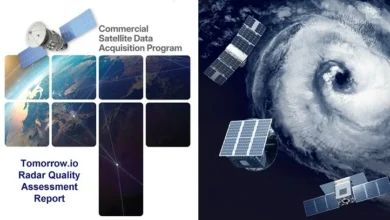
NASA CSDA Program Approves Satellogic NewSat Constellation for Scientific Use Following Comprehensive Quality Assessment Report
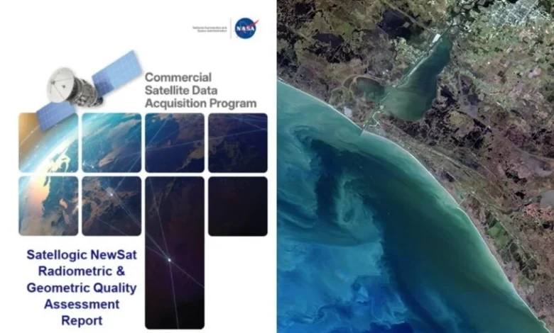
In a significant milestone for the integration of commercial aerospace technology into federal research frameworks, NASA’s Commercial Satellite Data Acquisition (CSDA) program has formally approved the use of data from Satellogic’s NewSat constellation for scientific research. This decision follows the release of a detailed quality assessment report on March 9, 2026, which concludes that the radiometric and geometric data products from Satellogic’s Mark IV and Mark V sensor generations meet the rigorous standards required for NASA-funded Earth science applications.
The report, titled Commercial Satellite Data Acquisition Program Satellogic NewSat Radiometric & Geometric Quality Assessment Report, serves as a technical roadmap of the evaluation conducted by NASA’s Earth science subject matter experts (SMEs). This approval marks a pivotal step in NASA’s ongoing effort to augment its traditional Earth observation missions with high-cadence, cost-effective data from the private sector. By validating Satellogic’s data, NASA provides its research community with a new toolset for monitoring planetary changes, managing natural resources, and responding to environmental crises.
Methodology and Technical Evaluation Standards
The validation process was led by a team of NASA SMEs tasked with determining whether commercial imagery could reliably supplement data from long-standing government missions such as Landsat and the European Space Agency’s Sentinel programs. The evaluation focused on 60 top-of-atmosphere (TOA) reflectance images captured by the NewSat constellation between 2021 and 2025. These images were selected across a diverse range of geographical sites to test the sensors under varying atmospheric and lighting conditions.
The assessment prioritized two primary categories: radiometric performance and geometric accuracy. Radiometry refers to the sensor’s ability to accurately measure the intensity of electromagnetic radiation, which is critical for identifying land cover types and monitoring vegetation health. Geometry refers to the spatial accuracy of the imagery, ensuring that every pixel is correctly mapped to its precise location on Earth’s surface.
According to the findings, the majority of Satellogic’s spectral bands performed within 10% of the reference values provided by the Aqua Moderate Resolution Imaging Spectroradiometer (MODIS), a benchmark sensor in Earth observation. Furthermore, more than half of the bands analyzed met the "Good" rating for signal-to-noise ratios (SNR), a metric that defines the clarity of the data against background electronic interference.
Comparative Performance of Mark IV and Mark V Sensors
A nuanced aspect of the report involves the performance comparison between the two generations of Satellogic sensors. The NewSat constellation is not a static fleet; it has evolved through various iterations, with the Mark IV and Mark V representing the current operational backbone.
The SMEs noted that geometric performance generally exceeded the specified sensor spatial response specifications for the constellation. However, the older Mark IV generation surprisingly outperformed the newer Mark V in specific spatial response metrics, earning an "Excellent" grade. In contrast, the Mark V received a "Basic" grade in this specific category.
Industry analysts suggest that such variations are common as companies transition between hardware generations, often balancing spatial resolution with other factors like spectral range or data throughput. Despite the "Basic" rating for Mark V spatial response, the overall geometric and radiometric integrity remained high enough to justify its use in broader scientific contexts.
The Role of the CSDA Program in Earth Science
NASA’s Earth Science Division (ESD) established the CSDA program in 2017 to address the growing "NewSpace" ecosystem. As private companies began launching large constellations of small satellites (smallsats), NASA recognized an opportunity to acquire data that offers higher temporal resolution—meaning more frequent revisits to the same spot on Earth—than traditional flagship missions can provide.
The CSDA program acts as a bridge, identifying emerging commercial vendors and putting their data through a structured "on-ramping" process. This process includes a pilot phase, a comprehensive evaluation phase, and finally, a sustainment phase where the data is made available to NASA-funded researchers.
The program’s evaluation criteria are exhaustive, encompassing:
- Data quality and consistency over time.
- Metadata accuracy and compliance with international standards.
- The vendor’s ability to provide reliable data delivery pipelines.
- The long-term viability of the constellation.
By leveraging these commercial partnerships, NASA can accelerate scientific discovery without the decade-long lead times and multi-billion-dollar price tags associated with building and launching its own bespoke satellite missions.
Chronology of the Satellogic Assessment
The path to approval for Satellogic has been a multi-year journey, reflecting the thoroughness of the CSDA’s vetting process.
- 2021–2024: Satellogic’s NewSat constellation underwent initial data collection. During this period, NASA researchers began preliminary assessments of the imagery’s utility for specific case studies in agriculture and forestry.
- Early 2025: The CSDA program formally initiated the SME-led radiometric and geometric quality assessment, focusing on the 60-image sample set.
- March 9, 2026: The final report was officially issued, granting "approved" status for scientific use.
- Post-Report Updates: Following the report’s release, Satellogic proactively adjusted its ground processing algorithms to address specific recommendations made by the NASA SMEs regarding the Mark V’s spatial response and spectral calibration.
- Current Status: The CSDA is currently engaged in a follow-up assessment of these revised data products. A supplemental report is expected in the coming months, which may see an upgrade in the ratings for the Mark V sensor generation.
Official Responses and Industry Impact
While official statements from NASA emphasize the technical rigor of the program, the broader Earth observation industry views this approval as a major validation for Satellogic. For a commercial vendor, receiving the "NASA seal of approval" is a significant market differentiator, signaling to other international space agencies and commercial clients that their data is of "science-grade" quality.
Satellogic has engaged closely with the CSDA throughout the process, even participating in a Vendor Focus Webinar to discuss their constellation’s capabilities and the lessons learned from the NASA evaluation. This level of transparency is encouraged by the CSDA, as it fosters a collaborative environment where commercial innovation meets government-level precision.
The scientific community has reacted positively to the news. "The inclusion of Satellogic data into the CSDA portfolio is a win for researchers who need high-resolution imagery with high revisit rates," said one Earth science researcher specializing in urban heat island effects. "While Landsat provides the gold-standard historical record, commercial constellations like NewSat allow us to see changes happening on a weekly or even daily basis."
Broader Implications for Global Observation
The approval of Satellogic’s data has implications that extend beyond the halls of NASA. As the private sector continues to outpace government agencies in launch frequency and sensor iteration, the "hybrid" model of Earth observation—combining government and commercial assets—is becoming the global standard.
This synergy is particularly vital for addressing climate change and disaster response. For instance, in the event of a major flood or wildfire, the ability to task a commercial satellite for immediate, high-resolution imagery can provide first responders with actionable data that might not be available from a government satellite that isn’t scheduled to pass over the area for several more days.
Furthermore, the feedback loop established by the CSDA program helps commercial vendors improve their products. By identifying that the Mark V sensor had a "Basic" spatial response compared to the Mark IV’s "Excellent" rating, NASA provided Satellogic with the technical justification needed to refine their processing pipeline. This creates a rising tide that lifts the quality of commercial data across the entire industry.
Future Outlook
Looking ahead, the CSDA program intends to continue its streamlined evaluation process, which has been optimized through three successful on-ramp activities. As more vendors enter the market, the program’s role as a quality-control gatekeeper will only become more critical.
The partnership between NASA and Satellogic is expected to deepen as the company launches more satellites and further refines its sensor technology. The upcoming assessment of Satellogic’s revised products will likely focus on whether the software-based corrections have successfully bridged the performance gap between the Mark IV and Mark V sensors.
For the NASA Earth science research and applications community, the immediate takeaway is the availability of a robust new data source. The Satellogic NewSat constellation is now officially part of the toolkit used to understand our changing planet, proving once again that the future of space exploration and Earth observation lies in the seamless integration of public ambition and private innovation.
To access the full technical findings, the Satellogic NewSat Radiometric & Geometric Quality Assessment Report is available through the CSDA’s official website. Additionally, stakeholders and interested parties can view the CSDA Vendor Focus Webinar on Satellogic via the program’s YouTube channel to gain deeper insights into the constellation’s technical architecture and the future of this collaborative partnership.
